Skip navigation links

Buy now

Please purchase all our products from these authorized dealers only to ensure that you receive full support in Warranty and replacement matters.

GPSMAP 66sr

GPSMAP 66sr

Part Number 010-02431-04

SHOP ONLINE

GPSMAP 66sr GPSMAP 66sr GPSMAP 66sr GPSMAP 66sr GPSMAP 66sr

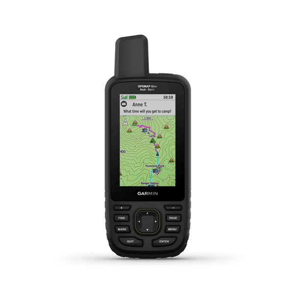
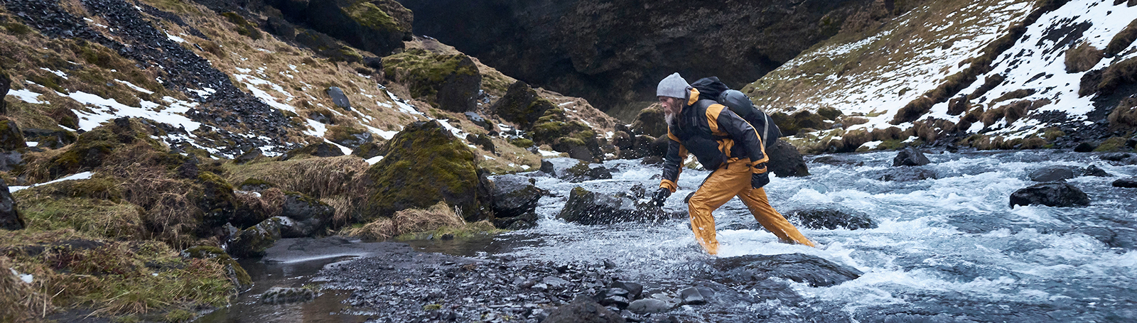
NAVIGATE YOUR NEXT ADVENTURE

Whether you’re hiking, hunting, climbing, geocaching, kayaking or mountain biking, explore more by using this premium, rugged handheld with a 3” color display, preloaded maps and multiple frequencies for our most accurate position to date.

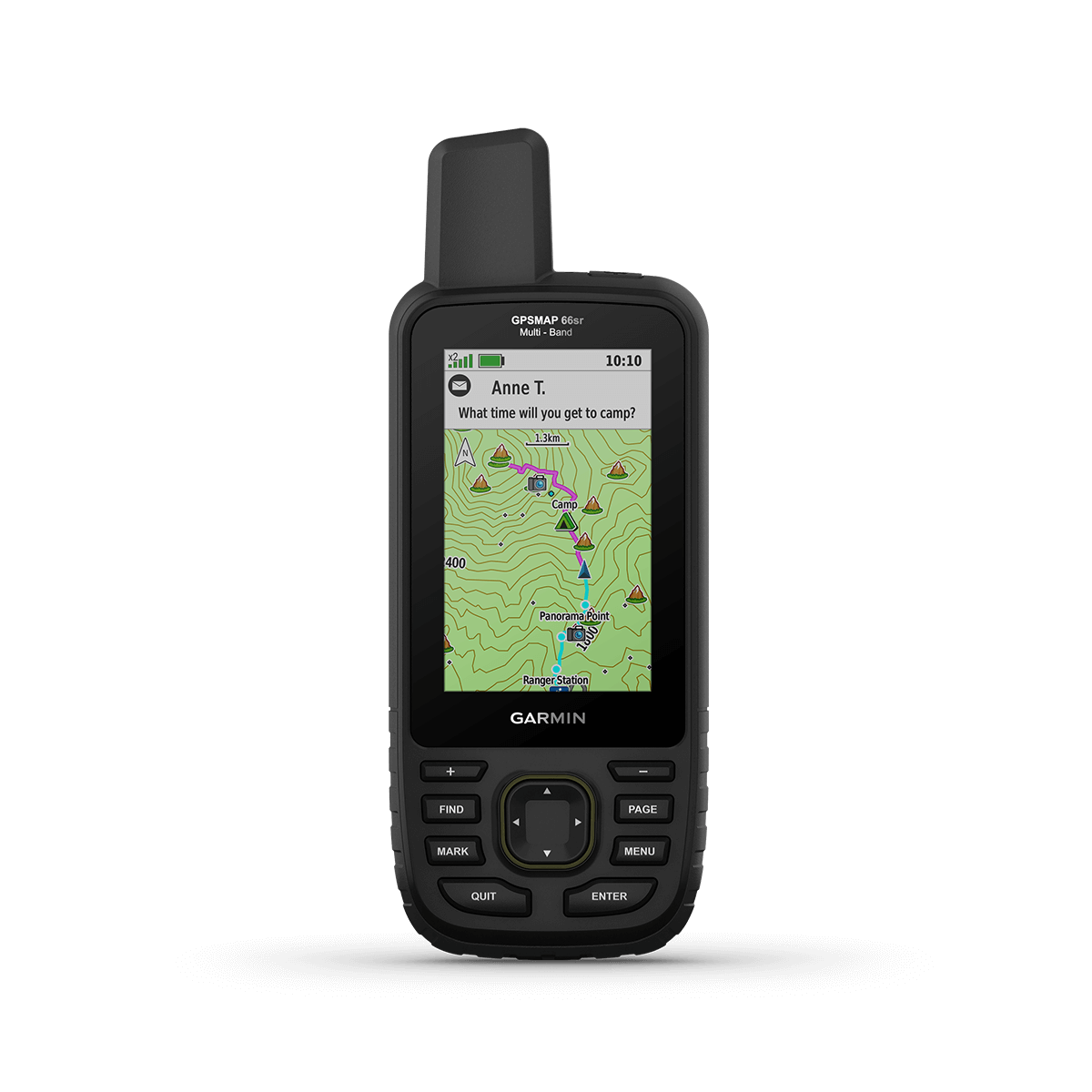
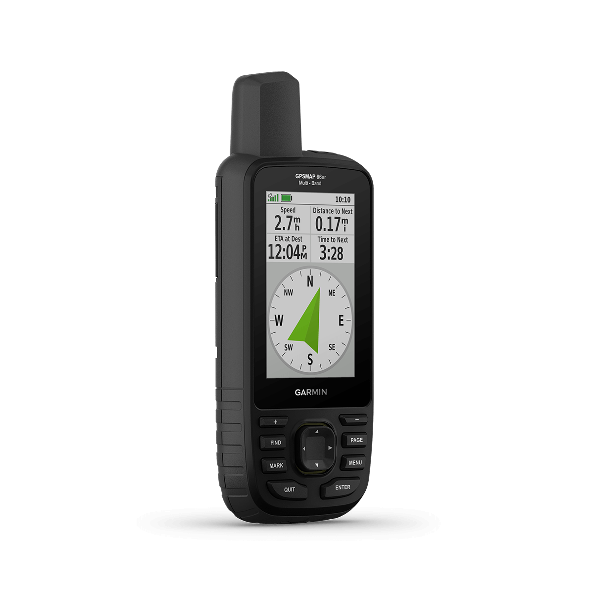
No squinting necessary with this large, sunlight-readable color display.

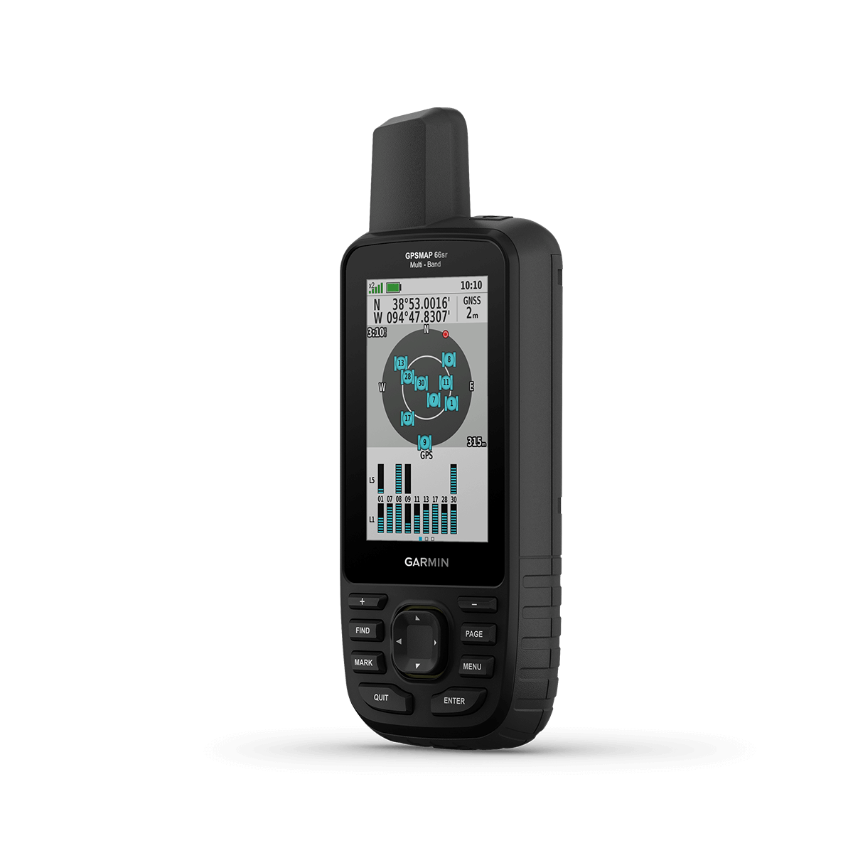
Multi-band technology and expanded GNSS satellite support guide the way in challenging locations.

Maps as pretty as a picture and just as detailed —without a subscription.

Having Active Weather is like having your own personal weather forecaster on your journey1.

Explore more with up to 36 hours of battery life in GPS mode and up to 450 hours in Expedition mode.

Know the way.

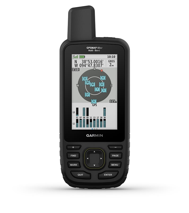
EXPANDED GNSS SUPPORT

Multi-band technology and expanded GNSS support (GPS, GLONASS, Galileo, QZSS and IRNSS) provide optimal accuracy in steep country, urban canyons and forests with dense trees.
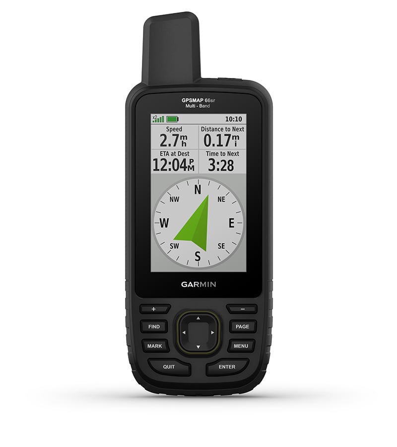
ABC SENSORS

Navigate every trail with ABC sensors, including an altimeter for elevation data, barometer to monitor weather and 3-axis electronic compass.

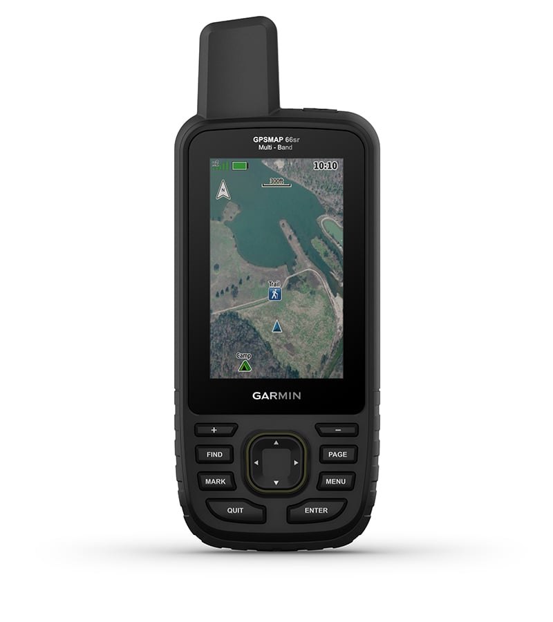
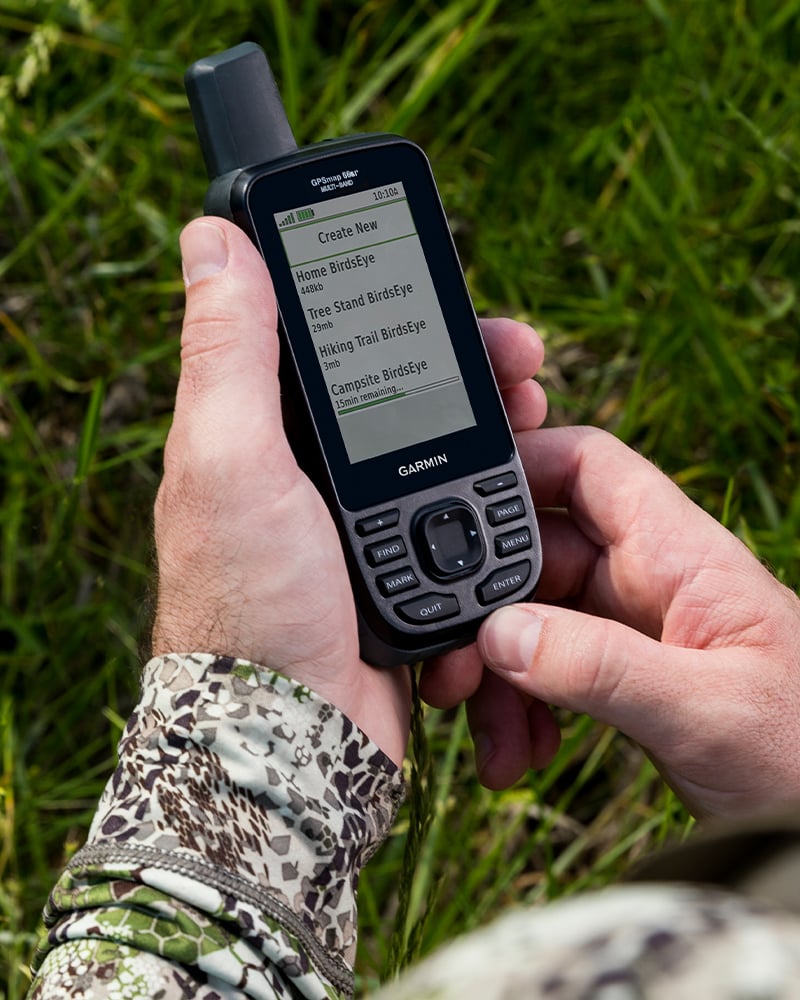
BIRDSEYE SATELLITE IMAGERY

Download high-resolution photo-realistic maps directly to your device without an annual subscription. Easily find trails, pick stand locations, find parking, create waypoints and more.
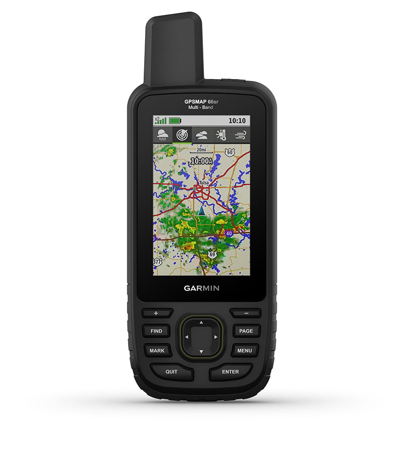
ACTIVE WEATHER

When paired with your compatible smartphone, you can get real-time forecast information and live weather radar, so you’re aware of the surrounding conditions1.


Be adventure ready.

BUILT FOR ADVENTURE

This handheld is built to military standards for thermal, shock and water performance (MIL-STD-810), and it’s even compatible with night vision goggles.

LED FLASHLIGHT

The GPSMAP 66 series helps you keep gear to a minimum with a built-in LED flashlight that can be used as a beacon to signal for help.

GEOCACHING

Get automatic cache updates from Geocaching Live, including descriptions, logs and hints. When connected via Wi-Fi® technology or to the Garmin Connect app2, each find will upload to your Geocaching.com profile.
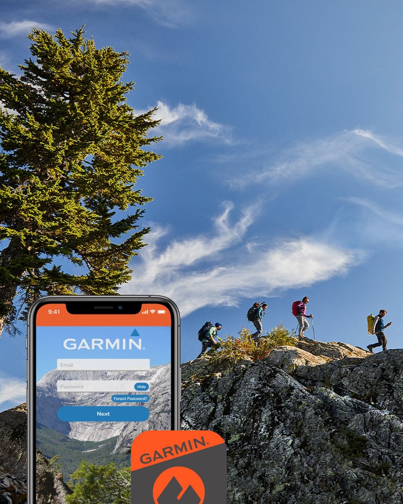
GARMIN EXPLORE APP

Plan, review and sync waypoints, routes and tracks by using the Garmin Explore app1 and website. You can even review completed activities while still in the field.

BATTERY LIFE

Internal Lithium-ion rechargeable battery provides up to 36 hours of battery life in GPS mode and up to 3 weeks in Expedition mode.


Garmin Explore app for off-grid navigation and more

1 When paired with your compatible smartphone; see Garmin.co.in/ble; not available in out-of-coverage areas
2 When paired with your compatible smartphone; see Garmin.co.in/ble
Wi-Fi is a registered trademark of the Wi-Fi Alliance.
ANT

General

PHYSICAL DIMENSIONS 2.5" x 6.4" x 1.4" (6.2 x 16.3 x 3.5 cm)
DISPLAY SIZE 1.5"W x 2.5"H (3.8 x 6.3 cm); 3" diag (7.6 cm)
DISPLAY RESOLUTION 240 x 400 pixels
DISPLAY TYPE transflective color TFT
WEIGHT

8.1 oz (230 g) with batteries

BATTERY TYPE Rechargeable, internal lithium-ion
BATTERY LIFE

Up to 36 hours
Up to 450 hours in expedition mode

WATER RATING IPX7
MIL-STD-810 (thermal, shock, water)
HIGH-SENSITIVITY RECEIVER  
INTERFACE high speed micro USB and NMEA 0183 compatible
MEMORY/HISTORY 16 GB (user space varies based on included mapping)

Maps & Memory

PRELOADED MAPS (basemap only)
ABILITY TO ADD MAPS  
BASEMAP  
AUTOMATIC ROUTING (TURN BY TURN ROUTING ON ROADS)  
MAP SEGMENTS 15000
BIRDSEYE (direct to device)
EXTERNAL MEMORY STORAGE (32 GB max microSD card)
WAYPOINTS/FAVORITES/LOCATIONS 10000
TRACKS 250
TRACK LOG 20000 points, 250 saved gpx tracks, 300 saved fit activities
ROUTES 250, 250 points per route; 50 points auto routing
RINEX LOGGING  

Sensors

GPS  
NavIC (IRNSS)  
GLONASS  
GALILEO  
BAROMETRIC ALTIMETER  
COMPASS (tilt-compensated 3-axis)
GPS COMPASS (WHILE MOVING)  

Daily Smart Features

CONNECT IQ (DOWNLOADABLE WATCH FACES, DATA FIELDS, WIDGETS AND APPS)  
VIRB REMOTE  
PAIRS WITH GARMIN CONNECT MOBILE  
ACTIVE WEATHER   
SMART NOTIFICATIONS ON HANDHELD  

Safety and Tracking Features

LIVETRACK  

Outdoor Recreation

POINT-TO-POINT NAVIGATION  
COMPATIBLE WITH BASECAMP  
AREA CALCULATION  
HUNT/FISH CALENDAR  
SUN AND MOON INFORMATION  
XERO LOCATIONS  
GEOCACHING-FRIENDLY (Geocache Live)
CUSTOM MAPS COMPATIBLE (500 custom map tiles)
PICTURE VIEWER  
INREACH REMOTE WIDGET  
LED BEACON FLASHLIGHT  

Outdoor Applications

COMPATIBLE WITH GARMIN EXPLORE APP  
GARMIN EXPLORE WEBSITE COMPATIBLE  

Connections

WIRELESS CONNECTIVITY

yes (Wi-Fi®, BLUETOOTH®, ANT+®)

  • GPSMAP 66sr
  • USB cable
  • Carabiner clip
  • Documentation


Loading

Loading

Loading