Skip navigation links

Buy now

Please purchase all our products from these authorized dealers only to ensure that you receive full support in Warranty and replacement matters.

GPSMAP® 580
Discontinued

GPSMAP® 580

Part Number 010-00913-00

SHOP ONLINE

GPSMAP® 580 GPSMAP® 580 GPSMAP® 580 GPSMAP® 580

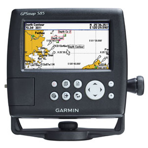
The GPSMAP 580 is a full-function chart plotter that features an ultra-bright 5” WQVGA color display along with an improved feature of high-speed map drawing and panning. It’s ready to go with an easy-to-use interface and a built-in worldwide basemap. The 580 is unique Garmin chart plotters that not only equip with English language but also with Asian languages including Simplified Chinese and Bahasa Indonesia. GPSMAP 580 is designed specifically for professional fishermen and comes with the advantages of Garmin’s renowned GPS168/178C chart plotters.


Explore the Seas

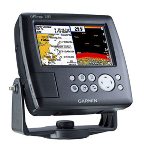
The GPSMAP 580 comes standard with a built-in high-sensitivity GPS module for superior satellite tracking and quicker acquisition times. And with an SD card slot, it’s easy to add additional maps without connecting to a computer


Physical & Performance:

Unit dimensions, WxHxD: 5.9" x 6.4" x 2.9" (15.0 x 16.3 x 7.4 cm)
Display size, WxH: 5”, 120.7x75.8mm
Display resolution, WxH: 480x272 pixels
Display type: WQVGA
Weight: 390g
Waterproof: yes (IPX7)

Maps & Memory:

Basemap: yes
Preloaded maps: no
Ability to add maps: yes
Accepts data cards: SD card slot
Waypoints/favorites/locations: 6000
Routes: 150 tracks/250 points

Features:

CANet® compatible: no
Supports AIS (tracks target ships' position): yes
Supports DSC (displays position data from DSC capable VHF radio): yes
Audible alarms: yes
Tide tables: yes
Sun and moon information: yes
3-D map view: no
  • GPSMAP 580
  • Bail mount
  • Power cable
  • Protective front cover
  • Owner's manual


Download the File
 

Software License Agreement

By downloading, installing, or using this software, you agree to be bound by the terms and conditions of the following license agreement. Please read this agreement carefully.

Garmin Corporation ("Garmin") grants you a limited, non-exclusive license to use the upgrade software ("Software") in binary executable form in the normal operation of the applicable Garmin products. Title, ownership rights, and intellectual property rights in and to the Software remain in Garmin. This license is personal to you and you may make copies of the software only for your personal use. You agree that this license agreement does not need to be signed for it to take effect.

The software is provided on an "as is" basis without warranty of any kind — either expressed or implied — including, without limitation, any implied warranties of merchantability or fitness for a particular purpose. Garmin does not warrant the performance of the software or that the software will meet your requirements or operate error free.

You acknowledge that this Software is the property of Garmin and is protected under United States of America copyright laws and international copyright treaties. You further acknowledge that the structure, organization, and code of the Software are valuable trade secrets of Garmin and that the Software in source code form remains a valuable trade secret of Garmin. You agree not to decompile, disassemble, modify, reverse assemble, reverse engineer, or reduce to human readable form the Software or any part thereof or create any derivative works based on the Software.

You agree not to export or re-export the Software to any country in violation of the export control laws of the United States of America.


2019/03/21

GPSMAP 580/585 v3.80

DownloadDownload(6.6 MB)

GPSMAP 580/585 v3.80

Release Note:

Changes made from version 3.70 to 3.80:

  • IDisable the update of scanned position for cursor
  • Fix SD logging path in log-consumer module
  • Enable QZSS support

Installation Instructions

  1. A maximum size 32GB SD card, formatted to FAT32, with 2GB of free space is needed for this update.
  2. Please back up your user data before applying the update.
  3. Click on 'Download' and choose to save the file to your computer.
  4. Choose a location where you can easily find the file, such as the 'My Documents' folder or 'C:\'.
  5. Once the download is complete, go to the location where you saved the file.
  6. Double-click on the downloaded file. This will automatically extract the files to C:\Garmin and run a program to transfer the software update to an SD card.
  7. Power on the device and make sure all attached network devices are powered on as well.
  8. Insert the card into the card slot of your primary device. Select 'Update Software' in the window that automatically displays. If you do not have a primary device with a card slot, please see your dealer.
  9. After the update completes, all Garmin Marine Network devices and NMEA 2000 sensors will have the latest software. This ensures all of the devices will be able to communicate with each other.

    Note: If you have additional chartplotters connected to NMEA 2000 and not the Garmin Marine Network, you will have to independently update each chartplotter. After the update of the Garmin Marine Network completes, insert the update card into each NMEA 2000 chartplotter.


System requirements:

  • IBM-compatible PC running Windows 2000 or later operating system and an available SD card reader.


Change History:

Version 2.20:

  1. Go to the last viewed function after reboot unit.
  2. Not allow using BACK key to get back to home page in Chart, Sonar and Radar pages.
  3. Change Korean font.
  4. Display current position legends while panning the cursor.
  5. Extend AIS/MARPA alarm distance up to 10 miles.
  6. Display legends on "New Route" and "New Boundary" map.
  7. User can hide waypoint symbol on boundary line.
  8. Duplicate duplicate data overlay in overlay number layout settings.
  9. Translation issues.
  10. Increase the waypoints, routes and tracks memory size.
  11. Add Function Mode setting to choose "All", "Sonar Only", and "Radar Only" functions.
  12. Change default chart page as "Navigation Chart".
  13. Add a "Chart Options" in chart menu.
  14. Close the menu window after the setting is applied by "Done" button.
  15. Support keypad handling for English keyboard.
  16. Resize the full screen display window after the menu popup for chart, sonar and Radar page.
  17. Display Gain manual level or Auto word at the display bottom of the left in sonar page.
  18. Combine all radar functions into one offshore mode.
  19. Show Sea Clutter and Rain Clutter information on the left-bottom data window on Radar page.
  20. Adjust the dual range radar menu.
  21. Adjust the vessel position to center in radar overlay.
  22. Add Look Ahead Speed setting in radar overlay menu.
  23. Use the last used waypoint symbol as default when user create the new waypoint.
  24. Bugs fixing.

Version 2.10:

  1. Added Shortcut Key feature.
  2. Supported Sonar Color Rejection.
  3. Supported Dual Range Radar.
  4. Supported Radar MARPA function.
  5. Added Boundary Line feature.

back to top


Loading

Loading