
9-inch Touchscreen Chartplotter/Sonar Combo
- 9-inch high-resolution intuitive touchscreen controls
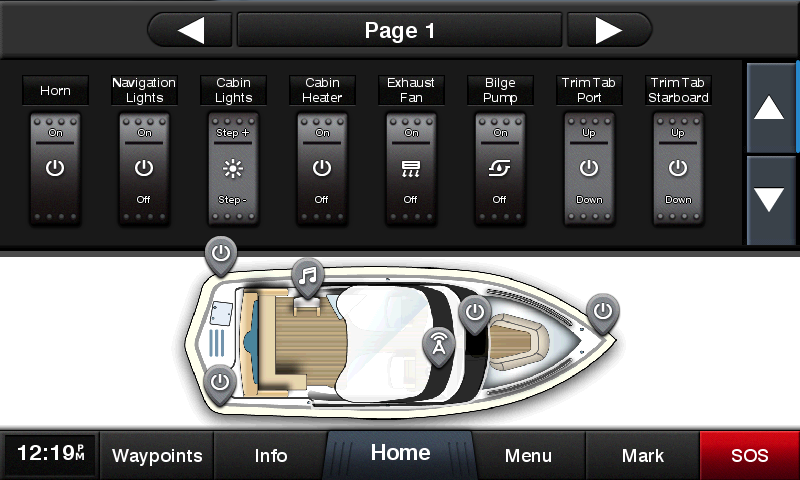
- NMEA 2000® and NMEA 0183 support for network connectivity, including autopilots, digital switching, weather, FUSION-Link, VHF, AIS and more
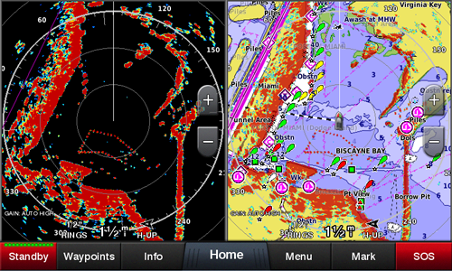
- Garmin Marine Network support for sharing sonar, including Panoptix™ sonar, maps, user data, radar and IP cameras among multiple units
- Supports optional BlueChart® g2 Vision® HD charts for Auto Guidance and other premium navigation features¹
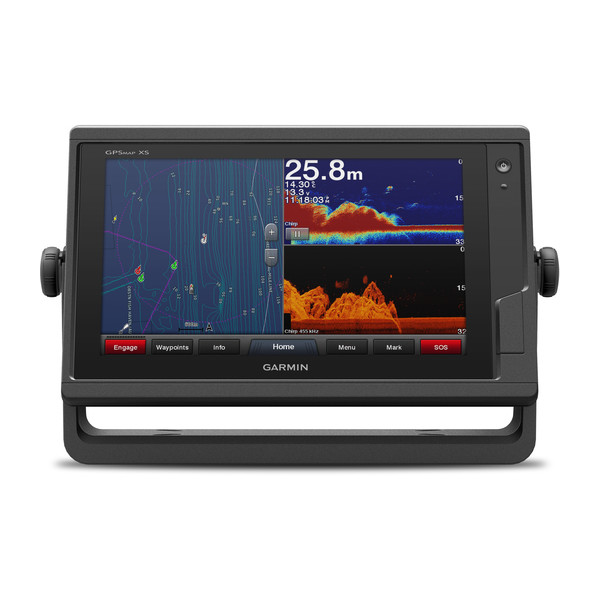
Experience an advanced navigation solution with this compact 9-inch GPSMAP 922xs touchscreen combo. Includes wireless connectivity features for Garmin mobile apps, NMEA 2000 support and Garmin Marine Network capabilities for radar and Panoptix all-seeing sonar, including Panoptix FrontVü collision avoidance sonar. It also has built-in Garmin CHIRP and CHIRP ClearVü sonar (transducer sold separately).
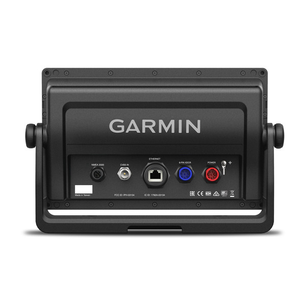
Garmin Marine Network and NMEA 2000 Support
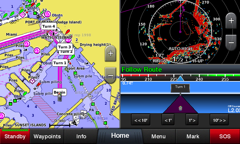
Full-network compatibility allows you to add more capabilities to your boat. Garmin Marine Network support allows sharing of sonar, including Panoptix sonar, maps, user data, Garmin radar and IP cameras among multiple units. Plus, there’s NMEA 2000 and NMEA 0183 support for connectivity, including autopilots, digital switching, weather, FUSION-Link, VHF, AIS and other sensors.
Built-in Wi-Fi® Connectivity
Enjoy built-in Wi-Fi connectivity for BlueChart Mobile 2.0 and Garmin Helm apps. Garmin Helm allows you to view and control your compatible chartplotter from a compatible smartphone or tablet while providing enhanced situational awareness for the mariner. With BlueChart Mobile, a free app downloaded from the App Store™, you can get reliable weather information while you plan marine routes on your iPad® or iPhone® then wirelessly transfer them to your boat’s compatible networked Garmin chartplotter. You can even stream and control a VIRB action camera from the chartplotter.
Built-in ANT® Connectivity
Enjoy built-in ANT wireless connectivity directly to quatix® marine watch, Garmin Nautix™ in-view display, gWind™ Wireless 2 transducer, GNX™ Wind marine instrument and wireless remote controls.
Built-in Sonar Capabilities
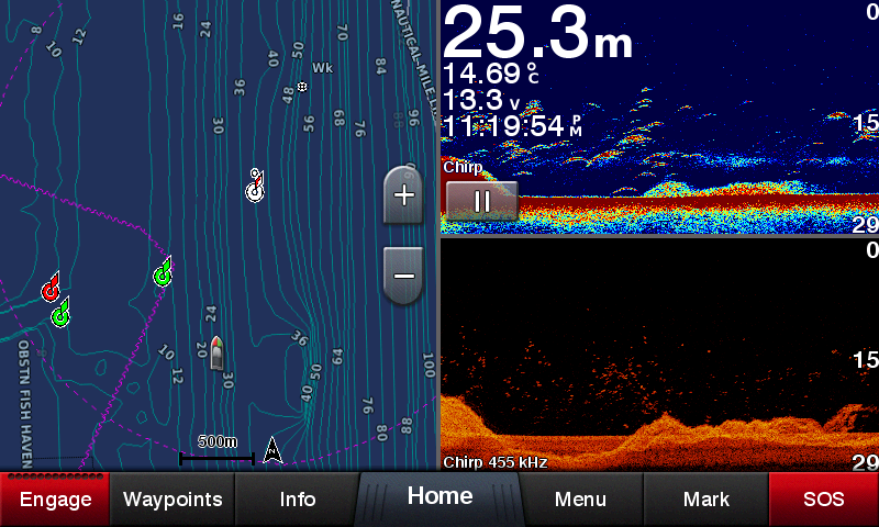
Right out of the box, you have access to some amazing sonar capabilities; all you add are transducers. Comes with built-in Garmin 1 kW CHIRP sonar and CHIRP ClearVü scanning sonar. It even supports Panoptix all-seeing sonar, premium Garmin sonar modules and a wide range of transducers (sold separately).
Networked combos can share their internal sonar with any other device on the network. You can also choose what information is overlaid on the sonar screen, for example, radar, time of day or GPS speed.
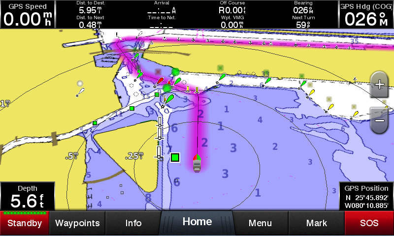
Heading and Position Refreshed 10 Times per Second
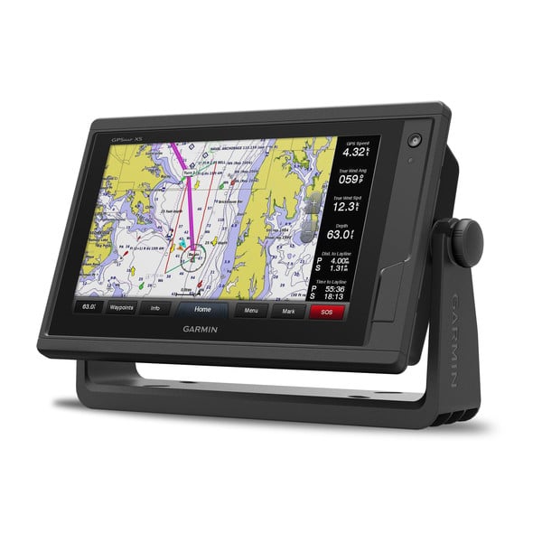
Fast, responsive built-in 10 Hz GPS and GLONASS receiver refreshes your position and heading 10 times each second to make your movement on the screen more fluid. It makes dropping up to 5,000 accurate waypoints — and finding your way back to them — quick and easy.
Upgrade to Our Best Maps on the Water
Include expandable memory for accessory map purchases, such as LakeVü HD Ultra with Max Def Lakes or BlueChart g2 Vision HD, which adds Garmin patented Auto Guidance¹ and other great features.
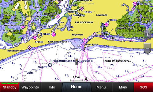
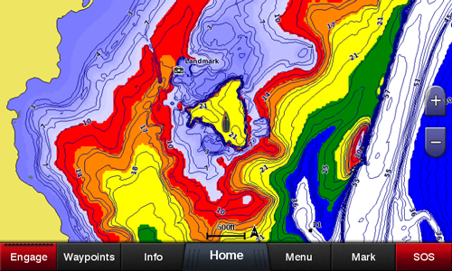
Quickdraw Contours to Create Your Own HD Maps
Instantly create personalized HD fishing maps onscreen with 1-foot contours. Tailor them to fit your needs. These are your maps — you own them. Keep the data to yourself, or share it with the Quickdraw Community on Garmin Connect™.
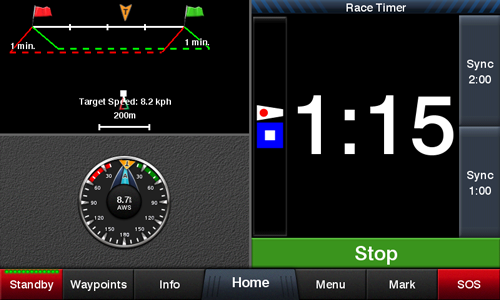
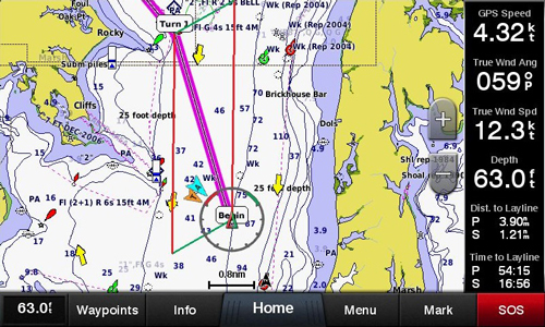
Built-in SailAssist Features
To help you gain a wind-maximizing competitive edge, your chartplotter features a pre-race guidance page that shows your virtual starting line along with data fields showing laylines, time to burn before the start and a race timer that can be synchronized across all your networked Garmin GPS products. In addition, other supported sailing features include an enhanced wind rose, heading and course-over-ground lines, set and drift, true and apparent wind data and more.
GPX Waypoints Transfer
If you have waypoints, tracks or frequently used routes stored on another manufacturer’s GPS product — or on a Garmin handheld device — it’s easy to transfer those items to your new Garmin chartplotter via industry-standard GPX software formatting.
¹Auto Guidance is for planning purposes only and does not replace safe navigation operations.
iPhone and iPad are trademarks of Apple Inc., registered in the U.S. and other countries. App Store is a service mark of Apple Inc. Wi-Fi is a registered trademark of the Wi-Fi Alliance.
![]()
![]()
![]()
![]()