Oregon® 750
KEY FEATURES

3" TOUCH SCREEN |

LIVETRACKING |

LIVE GEOCACHING |
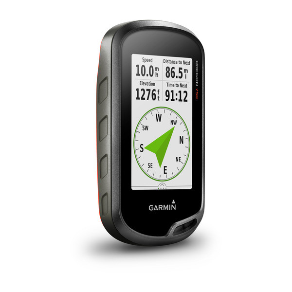
3D ELECTRONIC COMPASS |

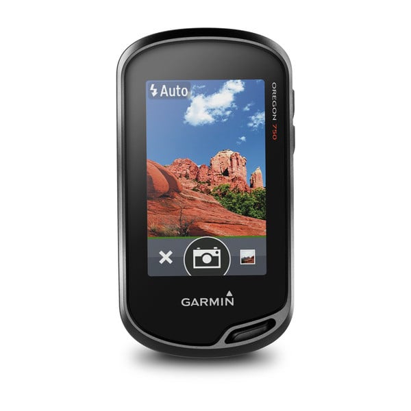
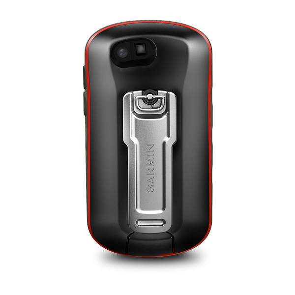
8MP DIGITAL CAMERA |

Thanks to a redesigned antenna for better satellite reception, the Oregon 750 GPS and GLONASS handheld puts even more of the great outdoors at your fingertips. Whether you’re hiking, hunting, climbing, kayaking, trail riding or whatever, this rugged navigator is ready for anything. It features multilink wireless connectivity (Wi-Fi, Bluetooth and ANT+) and a built-in 3-axis compass with barometric altimeter.
The expanded wireless capabilities of Oregon 750 make it easier than ever to download software, receive smart notifications¹ and upload adventures to Garmin Connect. You can even share LiveTrack location data or geocache discoveries, unit-to-unit, with other compatible Garmin handheld devices. Smart notifications via Bluetooth connectivity with a compatible smartphone let you receive emails, texts and alerts right on your device. So you can see what’s going on while you’re getting away from it all. Comes standard with a dual battery system that lets you use traditional AA batteries or a rechargeable NiMH power pack.
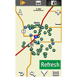
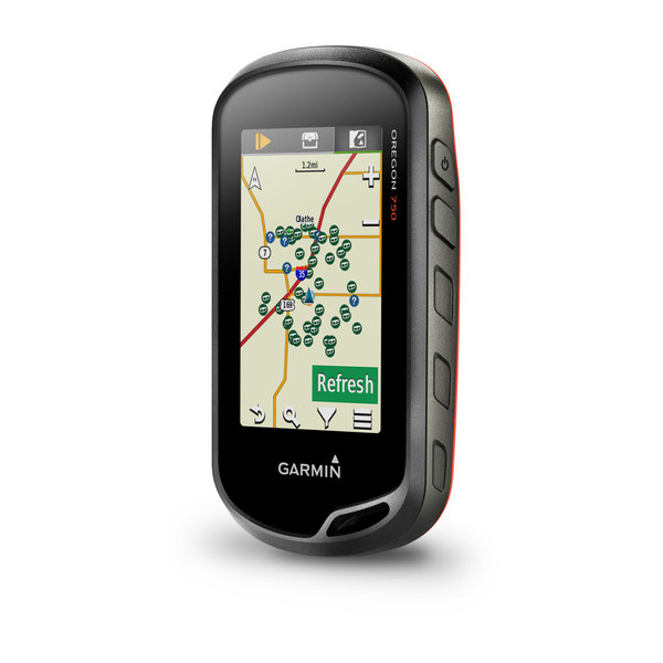
The wireless Wi-Fi and Bluetooth links on your Oregon 750 makes it easier than ever to enjoy a superior geocaching experience. You can set your device to automatically stay up to date with all the latest caches from Geocaching.com. No more manual entry of coordinates or printing out cache details on paper.
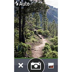
Capture locations and memories with the 8 megapixel digital camera. Each photo is automatically geotagged, allowing you to easily navigate back to that exact spot in the future. You can upload and share your favorite photos with friends via Garmin Adventures™, part of the Garmin online community.
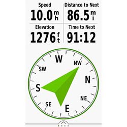
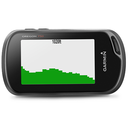
The Oregon 750 handheld provides comprehensive navigation and tracking to guide you on and off the beaten path, using GPS and GLONASS plus ABC (altimeter, barometer and compass) sensor capabilities. The built-in altimeter provides elevation data to accurately monitor ascent and descent, while the barometer can be used to predict weather changes by showing short-term trends in air pressure. The 3-axis electronic compass keeps your bearing, whether you’re moving or not. There’s also a TracBack® feature on Oregon 750 to help you navigate back to your starting point the same way you came. You can also mark locations, such as your campsite, vehicle or other points of interest, to which you'd like return navigation.
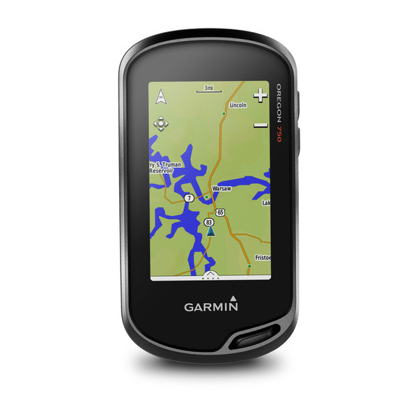
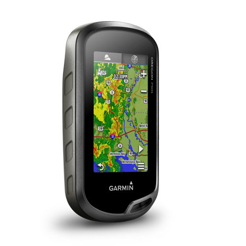
The Oregon 750 handheld features a bright, sunlight-readable 3-inch color touchscreen display with dual orientation for landscape or portrait views. It easily supports multiple mapping options such as BlueChart® g2 HD for water navigation or City Navigator® NT for turn-by-turn driving directions. Durable and water-rated to IPX7, the Oregon series is built to keep delivering vital mapping and tracking data, no matter what the elements throw at you. Plus, you can even customize your Oregon’s display with free downloads of apps, widgets and data fields from the Garmin Connect IQ™ online store².
Take charge of your next adventure with BaseCamp™, software that lets you view and organize maps, waypoints, routes and tracks. This free trip-planning software even allows you to create Garmin Adventures that you can share with friends, family or fellow explorers online. BaseCamp displays on your computer screen any topographic map data stored on the device, including contour lines and elevation profiles.
¹See Garmin.com/BLE for compatibility
²Apps, widgets and data fields will be introduced when they become available; not all products may be available all the time. Please check our website for current inventory of Connect IQ products
The Bluetooth® word mark and logos are registered trademarks owned by Bluetooth SIG, Inc. Wi-Fi® is a registered trademark of the Wi-Fi Alliance.
Physical & Performance |
|
| Physical dimensions | 2.4" x 4.5" x 1.3" (6.1 x 11.4 x 3.3 cm) |
| Display size, WxH | 1.5"W x 2.5"H (3.8 x 6.3 cm); 3" diag (7.6 cm) |
| Display resolution, WxH | 240 x 400 pixels |
| Display type | transflective color TFT touchscreen |
| Touchscreen | |
| Weight | 7.4 oz (209.8 g) with batteries |
| Battery | rechargeable NiMH pack (included) or 2 AA batteries (not included); NiMH or Lithium recommended |
| Battery life | up to 16 hours |
| Water rating | IPX7 |
| High-sensitivity receiver | |
| Interface | high-speed USB and NMEA 0183 compatible |
| Camera | (8 megapixel with autofocus; digital zoom) |
| Barometric altimeter | |
| Electronic compass | (tilt-compensated 3-axis) |
| Unit-to-unit transfer (shares data wirelessly with similar units) | (plus images and custom maps) |
Maps & Memory |
|
| Basemap | |
| Ability to add maps | |
| Built-in memory | 4 GB |
| Accepts data cards | microSD™ card up to 32 GB (not included) |
| Custom POIs (ability to add additional points of interest) | |
| Waypoints/favorites/locations | 10,000 |
| Routes | 250 |
| Track log | 20,000 points, 250 saved tracks |
Outdoor Features |
|
| Automatic routing (turn by turn routing on roads) | (with optional mapping for detailed roads) |
| Geocaching-friendly | (Paperless) |
| Custom maps compatible | |
| Hunt/fish calendar | |
| Sun and moon information | |
| Tide tables | (with optional Bluechart) |
| Area calculation | |
| Picture viewer | |
Garmin Connect™ |
|
| Garmin Connect™ compatible (online community where you analyze, categorize and share data) | |
Additional |
|
| Additional | Wireless compatible: yes (Wi-Fi, Bluetooth and ANT+) |
| Map segments:1500 | |
| Connect IQ compatible: yes (data fields) | |
| Flashlight: yes | |
Related