GPSMAP 1222 Plus


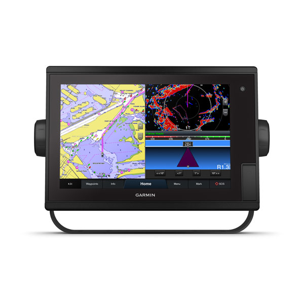
The bright, sunlight-readable 9” intuitive touchscreen chartplotter with enhanced map drawing is easy to use in any environment and seamlessly integrates into your Garmin marine system.
Easily integrate with more engines |
Connect to your favorite third-party devices |
Easily build your marine system using the best of network connectivity |
Compatible with premium maps and charts for the best in Garmin navigation |
Take the guesswork out of sailing with clear laylines and more right on the screen |
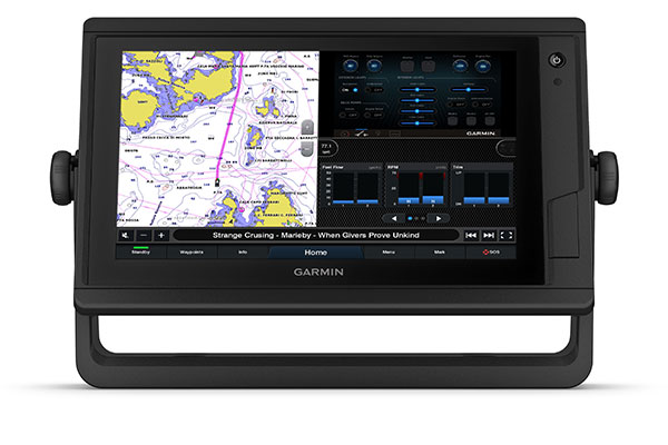
Manage your marine experience from nearly anywhere |

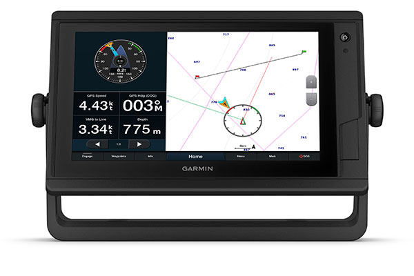
View laylines, race start line guidance, enhanced wind rose, heading and course-over-ground lines, true wind data fields and tide/current/time slider, wind angle, set and drift, wind speed and more.
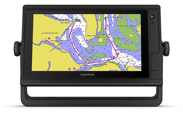
These optional charts offer the best of Garmin and Navionics data, Auto Guidance technology and other premium navigation features ¹.

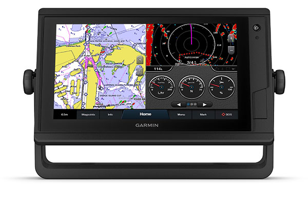
If you have multiple Garmin devices on your boat, you can share information — such as maps, user data, radar and IP cameras — among them.
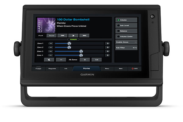
Connect to autopilots, digital switching, weather, FUSION-Link audio system, media, VHF, AIS and more from one screen.
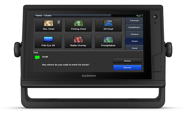
Built-in Wi-Fi connectivity pairs with the free all-in-one mobile app for access to the OneChart feature, smart notifications2, software updates, Garmin Helm, Garmin Quickdraw Community data and more.
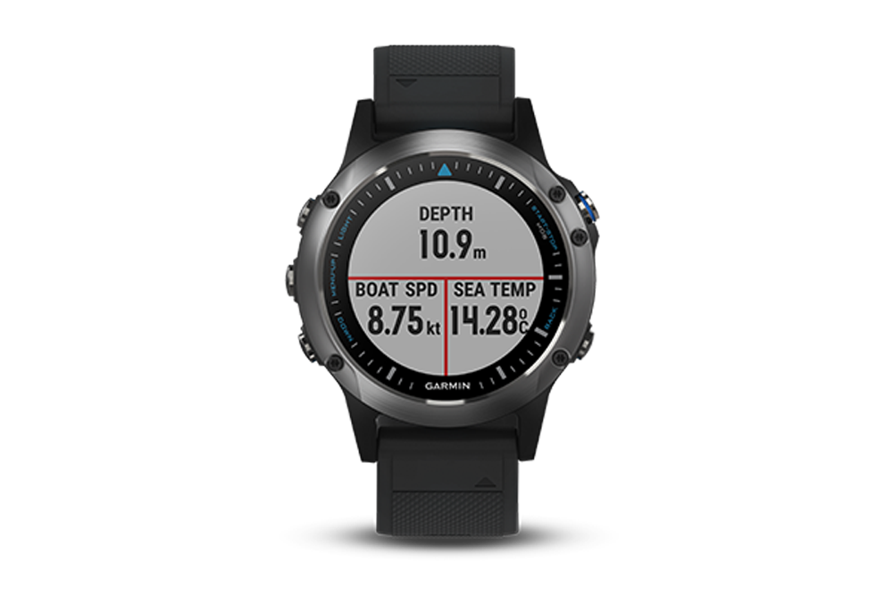
Connect with some of your favorite devices, such as quatix marine watches, gWind Wireless 2 transducers, GNX Wind marine instruments and wireless remote controls.
Now you can connect your chartplotter to different kinds of engines, including Yamaha engines.
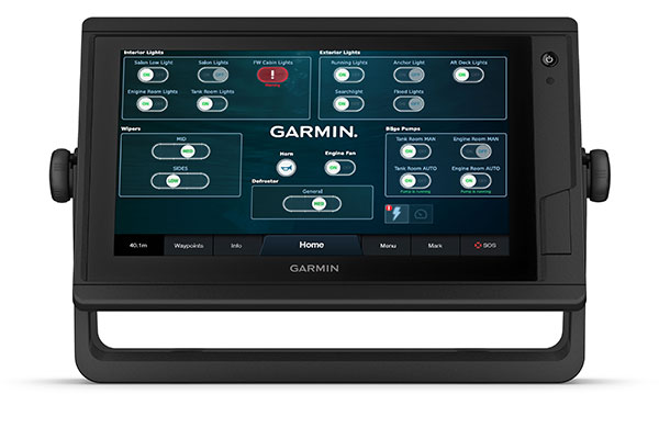
This exclusive feature brings together all the operations and capabilities of third-party devices, such as EmpirBus digital switching, on one screen.

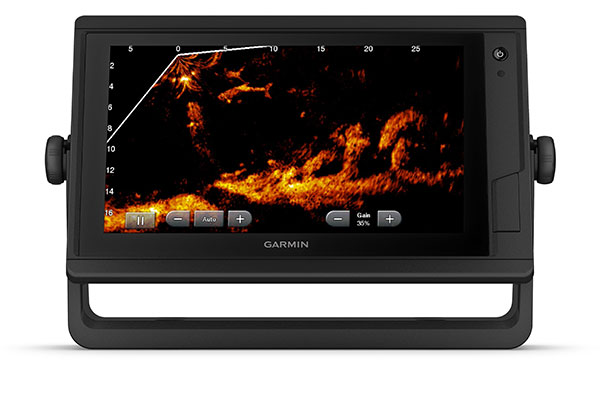
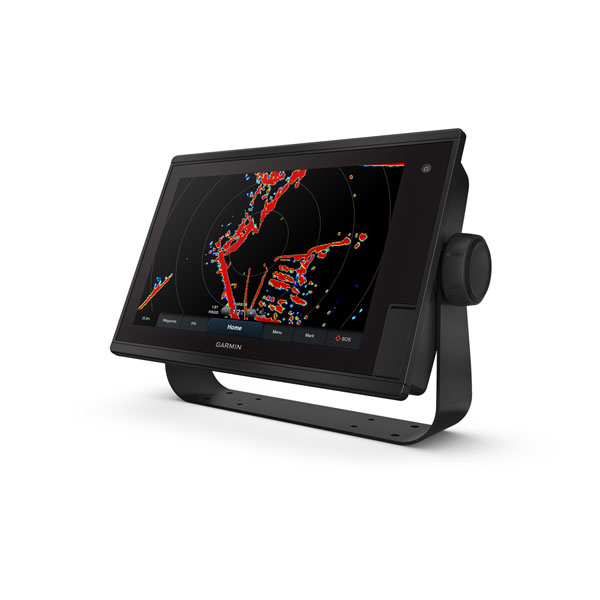
Pair with Panoptix or Panoptix LiveScope easy-to-interpret live sonar (transducer sold separately) to see all around your boat in real time.

¹ Auto Guidance is for planning purposes only and does not replace safe navigation operations
² When paired with a compatible smartphone
Wi-Fi is a registered trademark of the Wi-Fi Alliance.
General |
|
| Physical dimensions | 13” x 8.9” x 3.1” (33.0 x 22.6 x 7.9 cm) |
| Display size |
10.3" x 6.4"; 12.1" diagonal (26.2 x 16.3 cm; 30.7 cm diagonal) |
| Display resolution | 1280 x 800 pixels |
| Display type | WXGA display |
| Weight |
5.8 lbs. (2.6 kg) |
| Water rating | IPX7 |
| Polarized Support | |
| J1939 Compatible | |
| Power consumption |
Max power usage at 10 Vdc: 34.8 W Typical current draw at 12 Vdc: 2.2 A Max current draw at 12 Vdc: 2.9 A |
| Antenna | Internal or external over NMEA 2000 |
| Mounting options | Bail or flush |
| Receiver | 10 Hz high-sensitivity |
| Garmin Marine Network ports |
2 |
Maps & Memory |
|
| Preloaded maps |
None |
| Accepts data cards |
2 SD cards; 32 GB max |
| Waypoints | 5,000 |
| Routes | 100 |
| Track log | 50,000 points; 50 saved tracks |
Outdoor Recreation Features |
|
| Tide tables | |
Chartplotter Features |
|
| Garmin Radar compatible | |
| Garmin Sonar compatible |
Yes (with external black box, sold separately) |
| Garmin SmartMode compatible (customizable monitor presets) | |
| Supports AIS (tracks target ships position) | |
| Supports DSC (displays position data from DSC-capable VHF radio) | |
| Supports FUSION-Link compatible radios | |
| GSD Black Box sonar support | |
| GCV Black Box sonar support | |
| ActiveCaptain compatible | |
| GRID (Garmin Remote Input Device) compatible | |
| Wireless remote compatible | |
| Sailing Features | |
Sonar Features & Specifications |
|
| Dual-frequency (50/200 kHz) sonar capable | (with external black box, sold separately) |
| Dual-beam (77/200 kHz) sonar capable | (with external black box, sold separately) |
| CHIRP sonar technology | (with external black box, sold separately) |
| ClearVü | ((with external black box, sold separately) |
| SideVü | ((with external black box, sold separately) |
Connections |
|
| NMEA 2000 compatible | |
| NMEA 0183 input ports | 1 |
| NMEA 0183 output ports | 1 |
| Video input ports | 1 BNC |
| Video output ports | 1 HDMI |
| Wireless connectivity | |
Related